Zirui(Iris) Chen

Data Analytics and Spatial Analysis
Master of City Planning(Transportation & Smart Cities), University of Pennsylvania, 2021
View My LinkedIn Profile
Zirui’s Portfolio
Machine Learning With Python
Understand Travel Mode Choice, USA
Skills used: Python, Machine Learning (Scikit-learn), Data Visualization (Altair, HvPlot, Seaborn, Folium, Panel)
The project is to understand travel mode choice in the U.S. through using the 2017 National Household Travel Survey and vairous data visualziation techniques. Besides, we used different machine learning methods to predict travel mode choice along with socio-economic characteristics, trip characteristics and land-use characteristics.

Machine Learning With R
A Fire Response Situational Awareness API, Philadelphia
Skills used: R, Logistic Regression, Random Forest, API
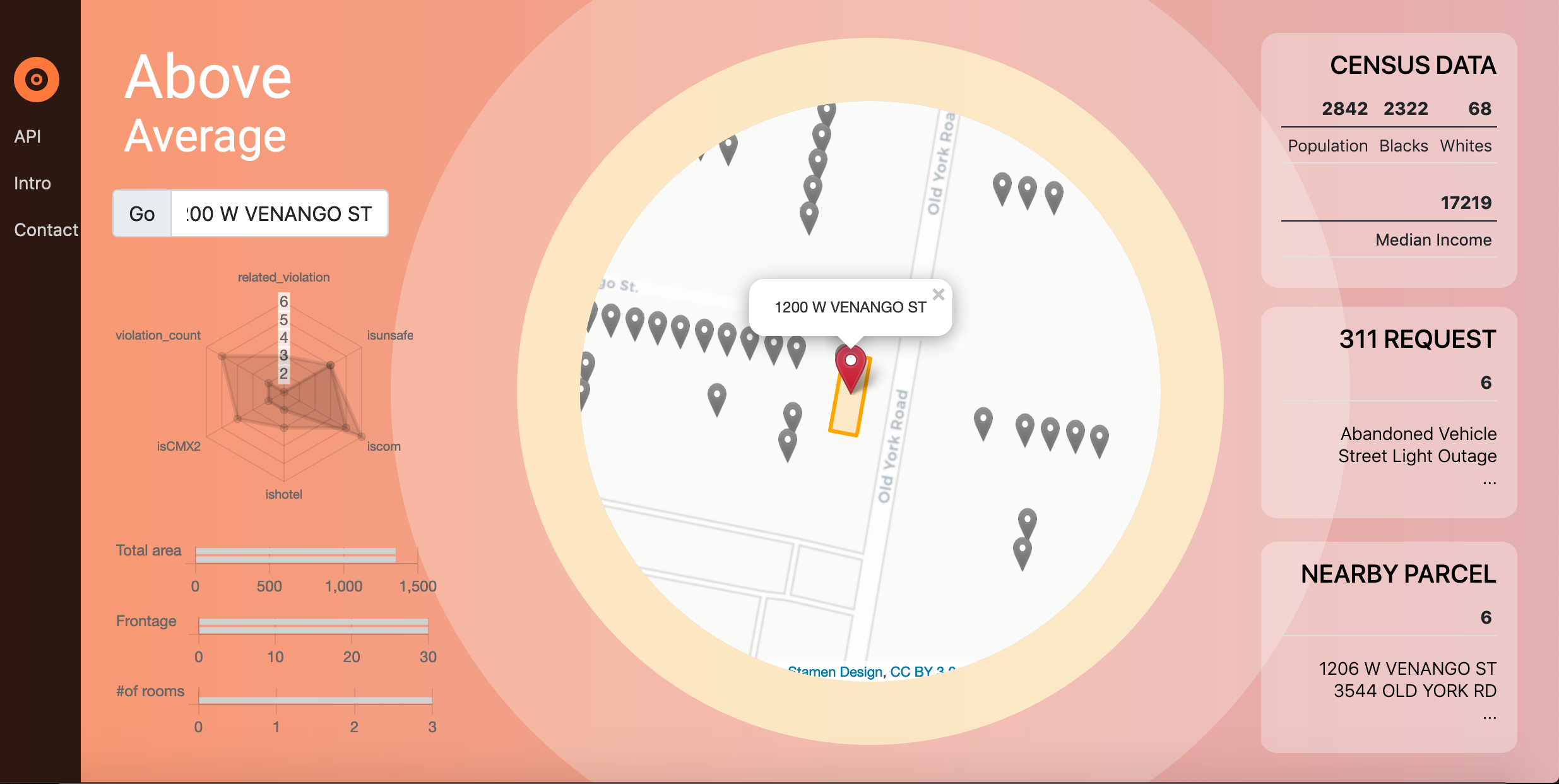
The project is intended to present the methodology of an analysis of property fire risk in Philadelphia and an API tool that aims to improve the fire department’s situational awareness. This new API tool can provide real-time information and assessment for all parcels in the city. We also built an web application using the API. Click here to check out the app!

Train occupancy prediction, Belgium
Skills used: R, Multinomial Logistic Regression, App Wireframe, Profit Optimization
In this project, we built multinomial logit models to spatially predict the occupancy levels of Belgian. Specifically, the spatial network of the trains was analyzed to select the OD pairs and train lines with certain characteristics of occupancy levels to increase accuracy but ensure generalizability.Cost-benefit analysis was used to adjust the model. The final model has a relatively high total accuracy of 0.7 and a satisfying generalizability.

We also designed a website called SmartOccupancy with 3 main functions to help transportation planners rebalance train services provision and maximize the profit. Check out the video here

Space-Time Prediction of Bike Share Demand, Philadelphia
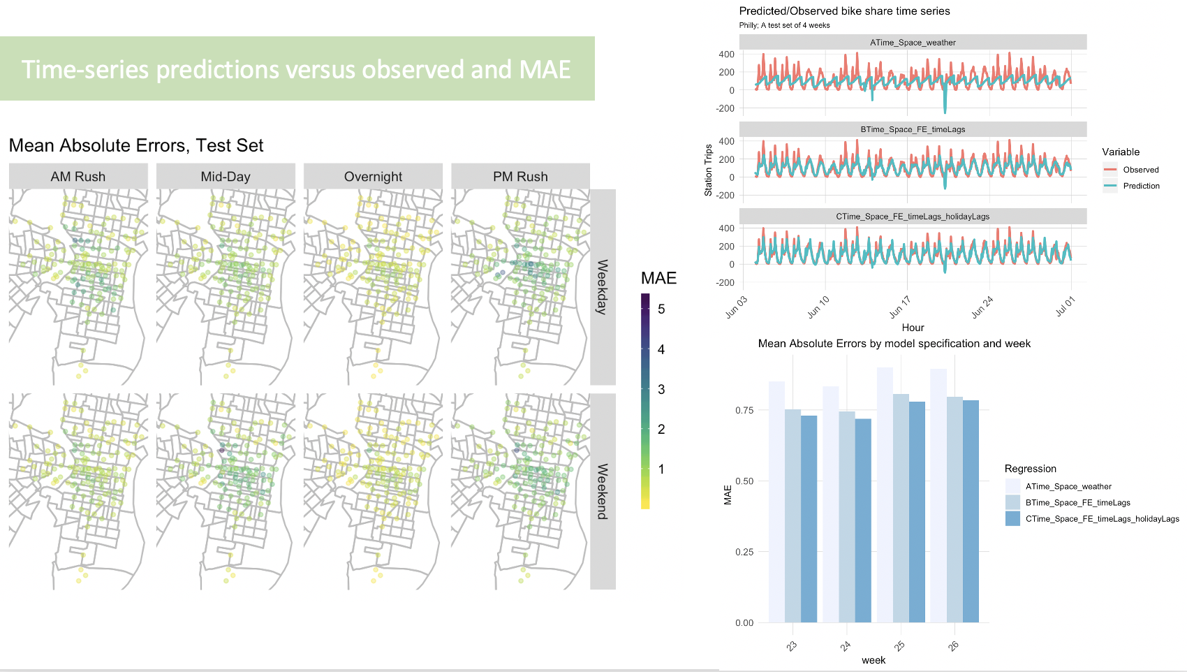
In this project, I use the Indego bike share data along with other related dataset including weather and census data. OLS models were trained to predict bike-share demand in space-time. The final model has relatively low MAE. The generalizability of the model was also analyzed.

Environmental Spatial Analysis
Analysis of Urban Sprawl in Guangdong Province, China
Skills used: Google Earth Engine
This project is going to analyze the characteristics and patterns of urban sprawl in Guangdong province, China. The change of urban built-up area, vegetation(NDVI), population density, and heat island effect, which are associated with urban sprawl phenomenon, are examined in the project. To analyze the urban sprawl phenomenon, one important step is to identify the extent of urban built-up area. Night light data is going to be used here to extract the urban built-up area. To understand the characteristics and patterns of urban sprawl, the change of vegetation, population density, and heat island effect will be analyzed. In this part, I will use Linear Regression to analyze multi-temporal data and understand the trends of each factor.

Urban Growth Modeling for Los Angeles Metropolitan Statistical Area, LA
Skills used: R, Urban Growth Model
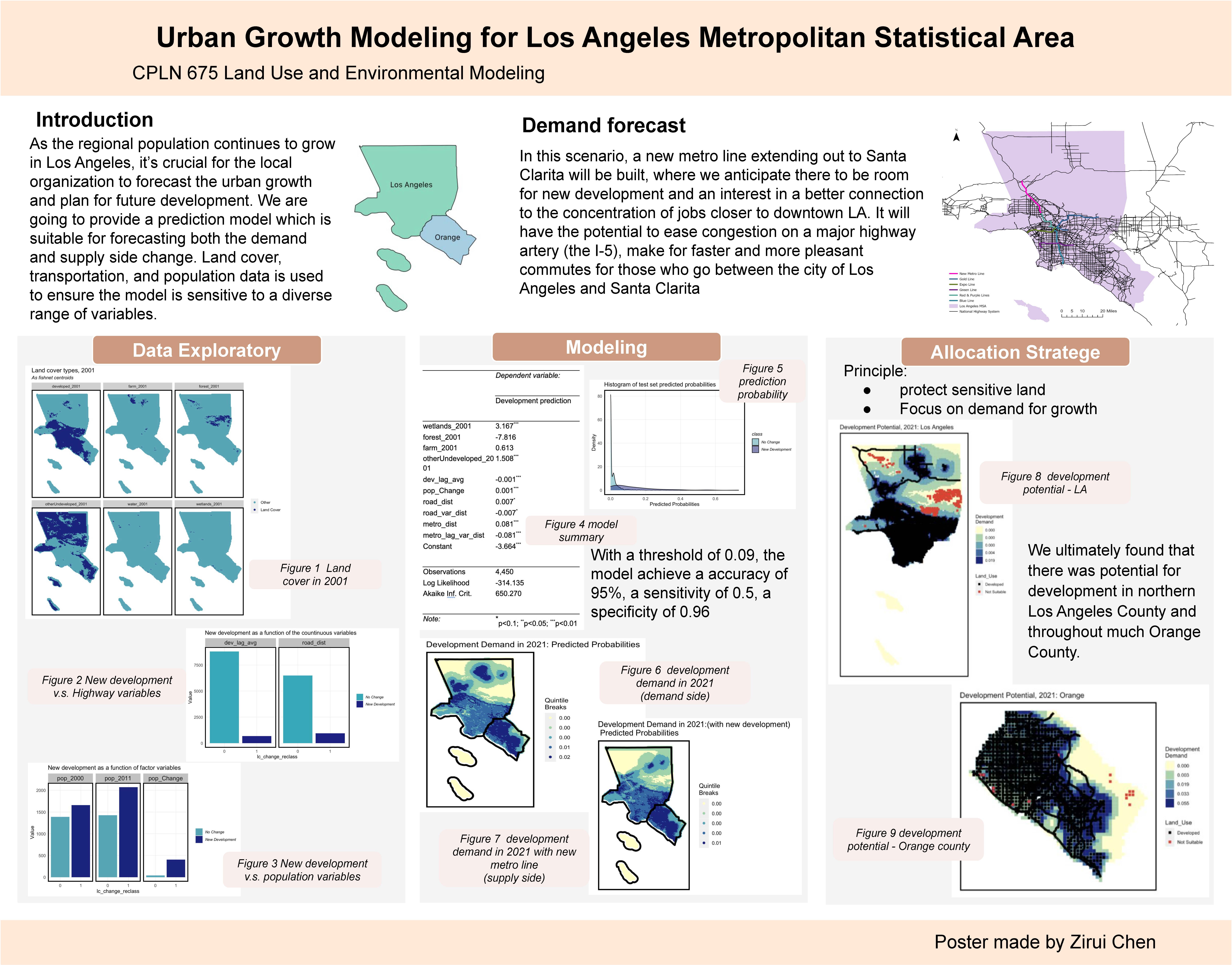
As the regional population continues to grow in Los Angeles, it’s crucial for the local organization to forecast the urban growth and plan for future development. We are going to provide a prediction model which is suitable for forecasting both the demand and supply side change. Land cover, transportation, and population data is used to ensure the model is sensitive to a diverse range of variables.

Planning Workshop: Oregon Avenue East Neighborhood Plan
Skills used: ArcGIS, Illustrator, InDesign
Existing Conditions, Transportation
Alternatives,Connect& Destination


Page template forked from evanca